Tillamook Fire District

Tillamook Fire District
County: Tillamook
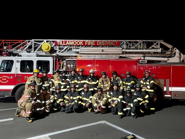
Tillamook Fire District was created in 1993 by a vote of the citizens of the City of Tillamook and the surrounding Tillamook Rural Fire Protection District. The result was the consolidation of two governing bodies into one.
Tillamook Fire District operates out of three fire stations located within the 97 square miles of district boundary and is dispatched by the Tillamook 911 center. The main fire station is located in the City of Tillamook and houses a vast majority of the district apparatus, equipment, and is the primary station. One satellite rural station is located in the Pleasant Valley area and another in the coastal community of Cape Meares. District volunteers operate from all stations.
The district provides fire protection and emergency services to approximately 11,000 full-time residents who live within the district boundaries of the City of Tillamook and the surrounding rural areas of Kilchis, Idaville, Cape Meares, Trask, Wilson, Fairview, South Prairie, Bewley Creek, and Pleasant Valley.
Boundaries
Online burn registration is not available here. Call Tillamook Fire District before burning. Tap a zone for its burn season and status.

Online burn registration is not available for this location.
Department Contacts
-
Public Status Page https://beforeyouburn.com/a/tillamook-fire-district
-
Non-Emergency Phone (503) 842-7587
-
Facebook Page https://www.facebook.com/profile.php?id=100057142252471
Boundaries
0 of 1 open- Tillamook Fire District, Station 73 - Cape Meares Online registration not available for this location Call Local Agency
Get notified
Tillamook Fire District doesn't post burn status here yet. Leave your email and we'll tell you once when it does. We'll send a code to confirm your address.
Unhealthy for Sensitive Groups
Fine particles (PM2.5), including smoke
Members of sensitive groups may experience health effects. The general public is less likely to be affected.
Nearby monitors · last 24 hours
7-Day Fire Weather Forecast
Tillamook Fire District, 2310 4th St, Tillamook, OR 97141, USA7-day outlook
1 of the next 7 days rate Moderate fire weather, and none rate High.
Wind is the cause. Gusts peak at 38 mph from the ESE on Tue 24 Nov. Rain is most likely on Sat 21 Nov (83%).
Forecast from NOAA GFS + HRRR (noaa.gov). Soil moisture comes from the standard NOAA forecast. Fire weather ratings are Before You Burn guidance, not an official fire danger rating. Always check your agency's burn status.
Brought To You By
For Residents
For Residents within the Tillamook Fire District jurisdiction: Sign in to learn about your local Outdoor Burning Regulations, communicate with your local fire agency officials, read condition reports, create and update your own outdoor burn status.
This service is free, brought to you by this public safety partnership with Tillamook Fire District.
About PFS
At PublicFireSafety.com (or PFS), our mission is to improve communication in public safety.
By coordinating the needs of our public safety agencies and the residents they serve, PFS is working with these professionals and residents to re-imagine permitting, regulations, safety and communication for modern communities.
Regional Partners
State of Oregon
Oregon is served by a coordinated network of state, regional, and local agencies that work together to protect communities, manage natural resources, and deliver essential services. From environmental protection to public safety, these agencies ensure responsive, equitable governance across the state’s diverse landscapes—supporting residents through collaboration, innovation, and a commitment to community well-being.