Klamath County Public Health

Klamath County Public Health
Check weather and wind before burning.
Klamath County Public Health
The notifications are determined by looking at weather information like temperature, wind speed and mixing height. Mixing height provides a forecast for how smoke will disburse or leave the Klamath Basin.
When temperatures are low and the skies are clear, the cold air moves below the warm air and traps the smoke in the Basin. This is called an inversion. In this case, mixing heights are low.
During inversions, wood burning creates more smoke in the air. Burning is restricted to reduce the amount of smoke, which can harm the health of sensitive or vulnerable people.
KCPH strongly encourages the community to use heating sources that are not wood-burning during these times to keep good air quality.
Boundaries
1 of 1 zone is open today. Tap a zone for its burn season and status.
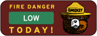
Check weather and wind before burning.
Department Contacts
-
Public Status Page https://beforeyouburn.com/a/klamath-county-public-health
Boundaries
1 of 1 open- Klamath County Air Quality Zone Open
Follow Klamath County Public Health
Get an email at 5 a.m. on mornings when burning has opened or closed here, in time to check in before you burn.
Sign in to follow
Good
Fine particles (PM2.5), including smoke
Air quality is satisfactory, and air pollution poses little or no risk.
Forecast
Nearby monitors · last 24 hours
7-Day Fire Weather Forecast
Klamath County Public Health, 3314 Vandenberg Ave, Klamath Falls, OR 97603, USA7-day outlook
1 of the next 7 days rate Moderate fire weather, and none rate High.
Wind is the cause. Gusts peak at 42 mph from the SSE on Wed 25 Nov. Rain chances stay at 35% or below.
Forecast from NOAA GFS + HRRR (noaa.gov). Soil moisture comes from the standard NOAA forecast. Fire weather ratings are Before You Burn guidance, not an official fire danger rating. Always check your agency's burn status.
Brought To You By
For Residents
For Residents within the Klamath County Public Health jurisdiction: Sign in to learn about your local Outdoor Burning Regulations, communicate with your local fire agency officials, read condition reports, create and update your own outdoor burn status.
This service is free, brought to you by this public safety partnership with Klamath County Public Health.
About PFS
At PublicFireSafety.com (or PFS), our mission is to improve communication in public safety.
By coordinating the needs of our public safety agencies and the residents they serve, PFS is working with these professionals and residents to re-imagine permitting, regulations, safety and communication for modern communities.
Regional Partners
No regional partners available for this location.
This location is not supported in our system.